Four easy Central Oregon hikes
Published 3:00 am Friday, November 25, 2022
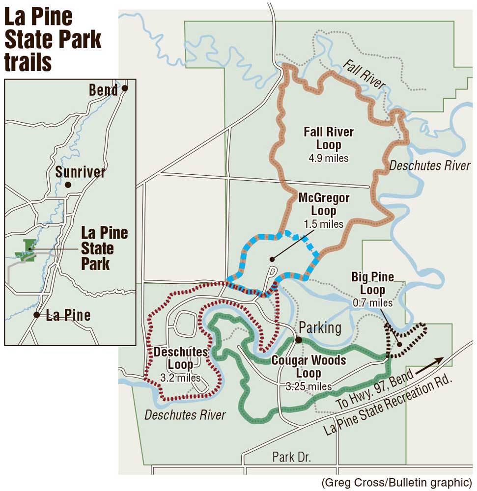
- La Pine State Park is home to the biggest ponderosa pine ever recorded.
After the indulgences of Thanksgiving, the outdoors will be beckoning. But when family and friends of all ages and abilities gather, it can be a challenge to choose an activity suitable for all. These four easy-to-moderate hikes are likely to satisfy everyone at the dinner table.
Trending
Big Tree via Cougar Woods Trail is a 1.5-mile out-and-back in La Pine State Park. The trail is easy, well-marked and features “Big Tree,” the biggest ponderosa pine ever recorded. Although “Big Tree” has lost half of its crown over the years due to the weather, the approximately 500-year-old tree remains the largest of its species in circumference at 28 feet, 11 inches, according to the Oregon Heritage Tree Program.
Ancient Juniper Trail is a quiet 3.1-mile loop in the Oregon Badlands Wilderness. There’s very little elevation change and after a layer of freshly fallen snow, the trail is still easy to follow thanks to the footprints of fellow hikers. There’s not much variation on this route, but the twisted ancient juniper trees lend a grandeur to the desert landscape. Extend the length of the hike to 7.5 miles by adding on the Flatiron Rock Loop at the Flatiron Rock-Ancient Juniper Trail Junction.
Located in the heart of Bend, the Deschutes River South Canyon Trail is a hike worth visiting time and time again. The popular 3.1-mile loop trail hugs the Deschutes River. It dips through the trees and over outcroppings of rock, crossing the river via the Conley Brooks Bridge at the midpoint of the loop. On the east side of the river, the trail narrows and is rocky in some places, which could pose a challenge to some hikers.
Trending
For those looking for a little extra challenge, there’s a breathtaking outlook over the Crooked River Gorge from Chimney Rock. The trail up to the summit is similarly rewarding with views of the 600-foot-high basalt walls up to cut into the gorge by the Lower Crooked River. The most difficult hike on this list, it involves a series of switchbacks with a total elevation gain of 623 feet, according to AllTrails. The trailhead for this 2.6-mile out-and-back is located on the east side of the Crooked River Highway opposite Chimney Rock Campground.
Marketplace

-
eEdition

-

-
