What’s coming to Cline Buttes Recreation Area?
Published 4:15 am Saturday, February 3, 2024
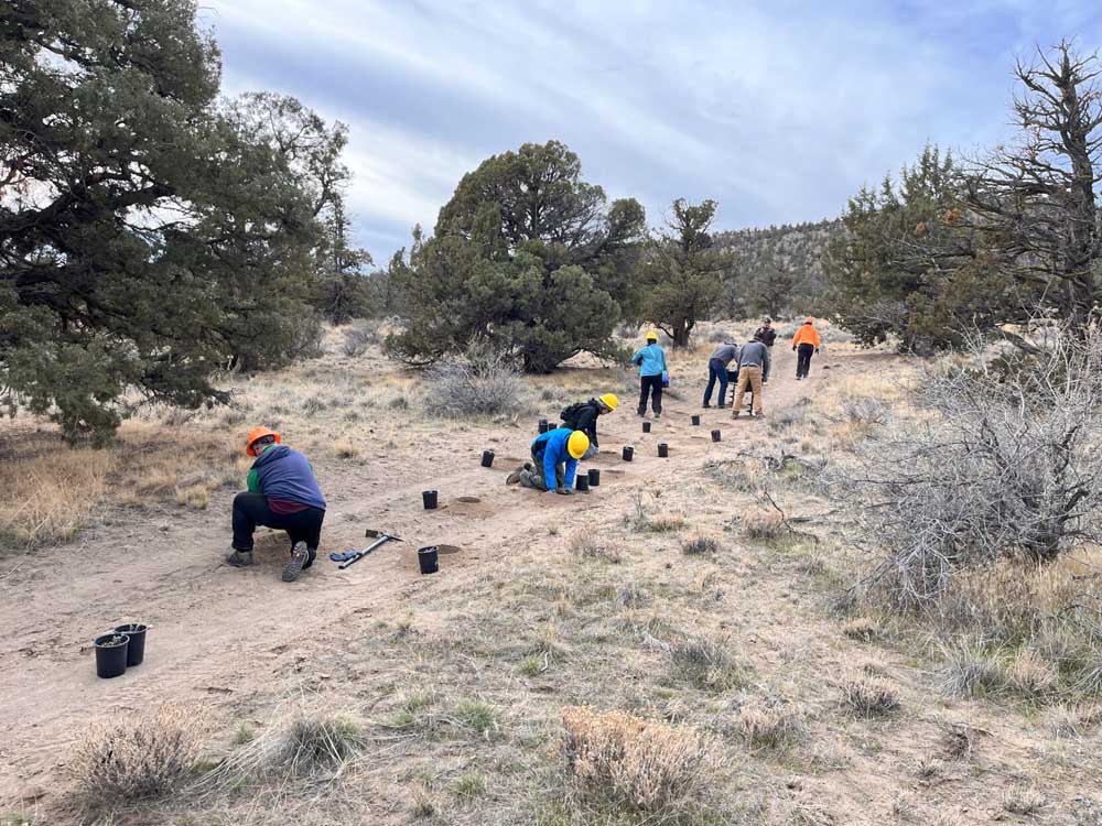
- Trail volunteers work on replanting at Cline Buttes Recreation Area
Major changes are coming to the Cline Buttes Recreation Area west of Redmond, and the first chunks of dirt are getting moved in the area.
In 2023, the Bureau of Land Managment, which manages the recreation area popular with bikers, hikers and horse riders, took a second look at the National Environmental Policy Act document that governs the property and eventually gave the green light to begin work on updating and expanding recreation on the butte.
Cline Butte is popular with mountain bikers as it provides steep technical terrain and can be ridden fall through spring, when most other bike trails are under snow or muddy. DH 1, 2 and 3 (“DH” as in downhill) will be made official with a few adjustments to avoid private property including the catch line that returns riders to the up trail. These trails will be designated one-way (downhill) and be open to bikes only. A new hike-only trail will connect the trailhead to the summit so hikers will have access to the views from the top. The old Saddle trail will remain but be closed February through August to protect nesting eagles in the vicinity, but a new trail will be built closer to DH 1 that will be open year-round for both uphill and downhill riding.
The Cline Butte Trailhead has been relocated on Cline Butte Rock Pit Road, across the highway from Juniper Trailhead. Improved parking, fencing and a toilet will be built. New trails will be built from the trailhead going north around the butte and connect to Cascade View trails and to the summit of the butte on the northwest side.
The 12.7 miles of existing mountain bike trails will almost double to 24.8 miles when the expansion is complete. In addition, the trails will create a way to connect Cascade View trails, which will also see Blue Belly expanded to be a loop and a new F trail, to the Buttes Area trails. Hopefully the future will see a trail connecting Cline Butte Trailhead to Maston Trails, but that requires collaboration with Oregon Department of Transportation as to how to safely get riders and hikers across the highway.
Hikers will have access to 15.7 miles of new trails in the buttes and southwest areas. Buttes-area hiking trails, designated for hiking only, are mostly in the northeast quadrant connecting to Eagle Crest Resort and a connector trail on the very north end to Cascade View trailhead. The southwest area, accessed at the Tumalo Canal trailhead, will also see an expansion of hike-only trails.
While only one new mile of equestrian trails will be added to the southwest area, in total the 48.5 miles of equestrian trails will grow to 55.1 miles throughout the entire area. Trails in the southwest will be open to equestrians and hikers only with no mountain bikes allowed in the area to avoid any conflicts.
This expansion is being done in an environmentally sensitive manner. Eagle habitat is being protected with reroutes, seasonal closures, and year-round areas where bikers must ride through and not stop to reduce disturbance. 56.7 miles of social trails and roads are being obliterated and rehabilitated to their undisturbed state. Trail networks are being connected to reduce driving and increase access for residents of Redmond, Sisters and Tumalo. Reroutes and adjustments have been made to keep all trails on BLM land so they will endure and not be lost to future development. The multi-user area will create opportunities for each user group to enjoy it without negatively impacting other users’ experiences.
It is truly exciting to have this project move into action. Work has already begun.
In the fall, the Redmond chapter of Central Oregon Trail Alliance started leading work parties with the Bureau of Land Management to obliterate trails and roads and start replanting. Oregon Equestrian Trails has received funding and started a robust signage project for the entire 86.4 miles of trail and two trailheads. COTA will begin construction of trails and toilets in late spring pending funding. The project is estimated to cost $500,000 — $90,000 for the toilet alone, through local and state grants as well as private donations. The goal is to have the work completed by 2026.
To get involved in the work or the funding of the trails, visit cotamtb.com.
To join work parties, visit meetup.com/cota-central-oregon-trail-alliance/
To donate to help realize this effort, visit app.moonclerk.com/pay/gy9fjiffw55


